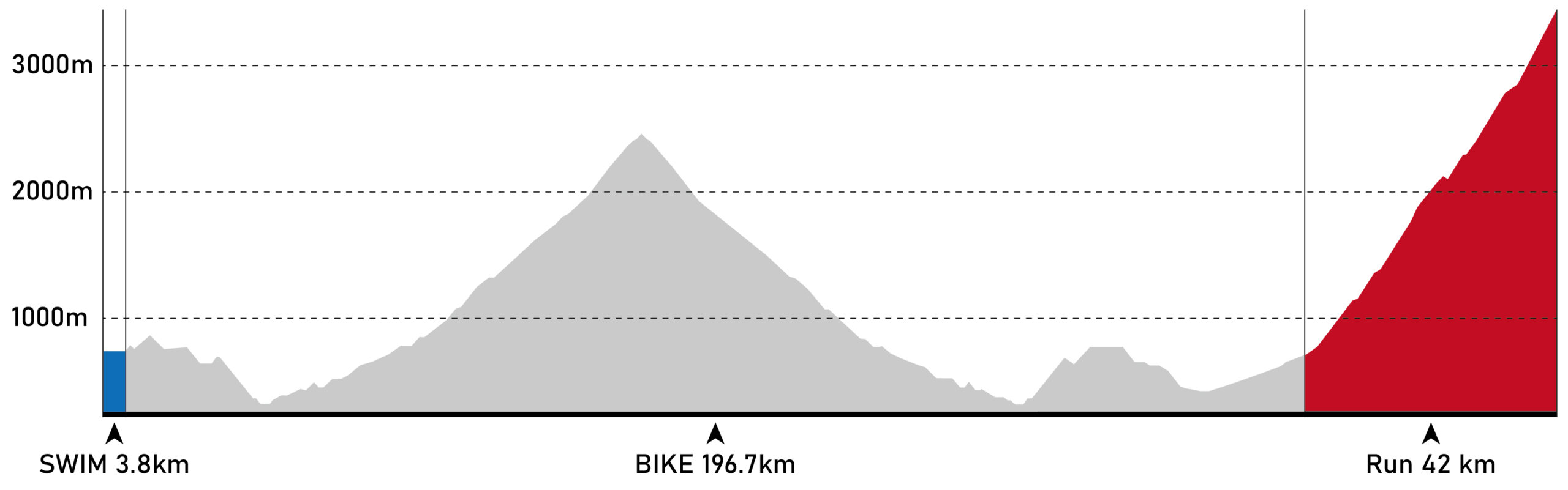
Schedule

DateTimeActivityLocation
16th NovemberTBCRegistration & Check-inTBC
TBCRace Briefing/ Welcome PartyTBC
17th NovemberTBCT1 OpenTBC
TBCBlessing CeremonyTBC
TBCSwim startTBC
TBCSwim cut-off(T1)TBC
TBCBike Cut Off 153.5 KMTBC
TBCBike Cut Off 173.5KM TBC
TBCBike cut-off(T2)TBC
TBCRun - 21.5 km check-point cut-offTBC
TBCRun - 30 km check-point cut-offTBC
TBCRun - 36 km check-point cut-offTBC
TBCRun - 40 km check-point cut-offTBC
18th NovemberTBCFinish party / ceremonyTBC

The race manual will release few months before the event.

Course

SWIM

3.8 km in the Xiuguluan River under New Changhong Bridge. It is the longest river in eastern Taiwan, and has abundant water all year round. The water temperature at the start point on race morning has been between 18 and 20 degrees Celsius.

BIKE

180 km from Cawi Tribe, Taitung. Up riding to the apex through Highway 193, across Highway 11 to Provincial Highway 8 to XingBiaYang, ending at transition zone (T2) in Baiyang Park

RUN

43.4km from Bilu Giant Tree towards Taroko National Park, and to the top of Mount. Wuling. It is a half road half trail course. The finish line would be at the top on Mt. HeHuan.

Total distance: 227.2 km (141.2 mi)
Total elevation: 6,895m